


DENISON 12 Voting District, Lawrence County, Illinois
About
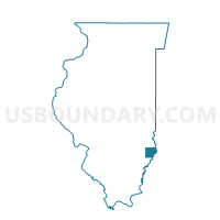
Outline

Summary
| Unique Area Identifier | 572565 |
| Name | DENISON 12 Voting District |
| County | Lawrence County |
| State | Illinois |
| Area (square miles) | 29.28 |
| Land Area (square miles) | 29.21 |
| Water Area (square miles) | 0.08 |
| % of Land Area | 99.74 |
| % of Water Area | 0.26 |
| Latitude of the Internal Point | 38.65688960 |
| Longtitude of the Internal Point | -87.68979960 |
Maps


Graphs
Select a template below for downloading or customizing gragh for DENISON 12 Voting District, Lawrence County, Illinois


Neighbors
Neighoring Voting District (by Name) Neighboring Voting District on the Map
- ALLISON 1 Voting District, Lawrence County, IL
- BRIDGEPORT 6 Voting District, Lawrence County, IL
- DENISON 11 Voting District, Lawrence County, IL
- LAWRENCE 14 Voting District, Lawrence County, IL
- LAWRENCE 18 Voting District, Lawrence County, IL
- LAWRENCE 22 Voting District, Lawrence County, IL
- LUKIN 24 Voting District, Lawrence County, IL
- VINCENNES TWP. 05, Knox County, IN
Top 10 Neighboring County Subdivision (by Population) Neighboring County Subdivision on the Map
- Vincennes township, Knox County, IN (23,707)
- Lawrence township, Lawrence County, IL (6,521)
- Bridgeport township, Lawrence County, IL (2,420)
- Denison township, Lawrence County, IL (1,558)
- Lukin township, Lawrence County, IL (429)
- Allison township, Lawrence County, IL (267)
Top 10 Neighboring Unified School District (by Population) Neighboring Unified School District on the Map
- Red Hill Community Unit School District 10, IL (8,629)
- Lawrence County Community Unit District 20, IL (8,313)
- South Knox School Corporation, IN (6,205)
Top 10 Neighboring State Legislative District Lower Chamber (by Population) Neighboring State Legislative District Lower Chamber on the Map
Top 10 Neighboring State Legislative District Upper Chamber (by Population) Neighboring State Legislative District Upper Chamber on the Map
Top 10 Neighboring 111th Congressional District (by Population) Neighboring 111th Congressional District on the Map
- Congressional District 8, IN (694,398)
- Congressional District 15, IL (681,580)
- Congressional District 19, IL (672,930)
Top 10 Neighboring Census Tract (by Population) Neighboring Census Tract on the Map
- Census Tract 8808, Lawrence County, IL (5,769)
- Census Tract 9559, Knox County, IN (5,670)
- Census Tract 8811, Lawrence County, IL (3,098)
- Census Tract 8809, Lawrence County, IL (2,834)